
Navigation & Tracking with Komoot: The Ultimate Bicycle Navigation App
Do you want to be on the safe side when it comes to navigation and do you want to go off the beaten track? Do you have a sports watch and love to track your tours live in combination with your own performance statistics? Are you interested in tour suggestions from other users in your region? If so, you need to read on, because in this blog article we will tell you about the core features of Komoot and why the app can be relevant for you on your tours.
Mehr als nur Fahrrad Navigation App
Komoot was founded in 2006 and now has over 18 million active users. We at Pedalmondo have tested the app several times on our own tours and still draw a very positive conclusion, not least because various relevant aspects are combined. So Komoot is not only a navigation app, but also an individual route planner and a social network, combined with a strong and intuitive user experience and attractive design.
Discover
A fundamental basis of Komoot are the contributions of the community, i.e. users who, for example, create certain highlights, pictures and descriptions of tours and thus in turn invite other users to interact with each other. In this way, you may learn about areas that you yourself may not yet know, and thus be inspired for your own tours. The "Discover" page is the entry point to the app and resembles a social feed as we know it from other social media platforms.
Planning
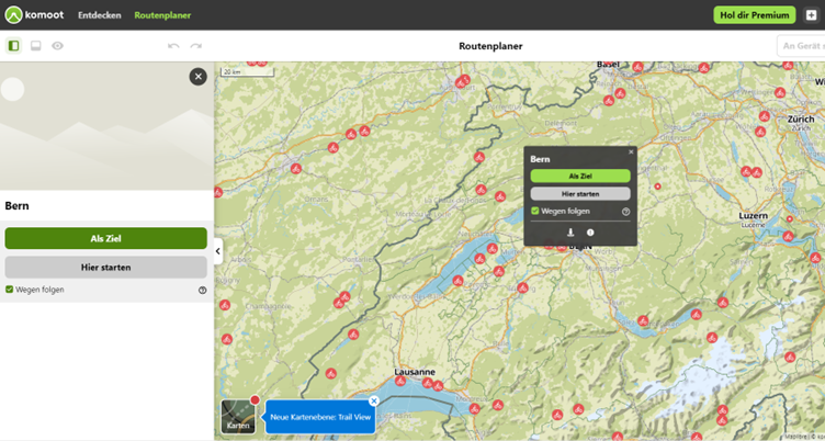
One of Komoot's core functions as a bike navigation app is the route planner, which works perfectly on both computers and cell phones. All you have to do is select a start and end point on the map, after which you will receive an initial route recommendation including various parameters such as the level of difficulty, the estimated time, the required fitness level, the altitude profile and the distance for this route. As a user, you then have the option of integrating as many stopovers as you like, which dynamically changes and recalculates the route and the parameters explained. During planning, you can display additional criteria directly on the map, such as highlights from other users, places of interest, parks, campsites and much more. Tip: if you want to make a very detailed planning of your tour, use the web version, there everything is a bit bigger and clearer.
Tracking & Navigation
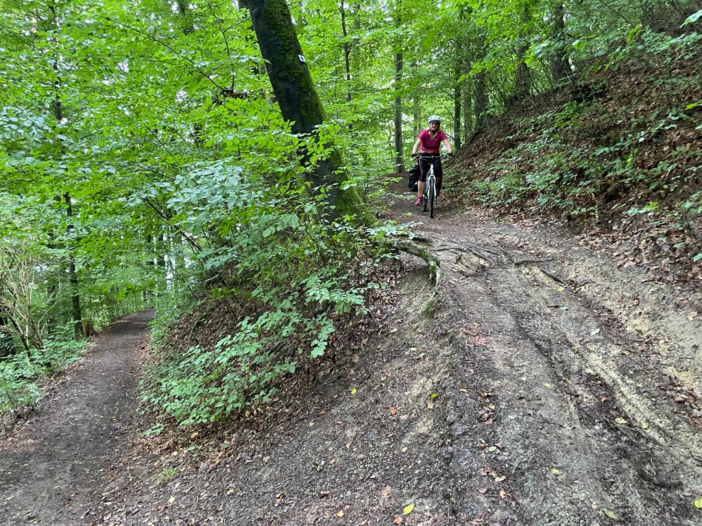
Once you have finalized your route, you can save it and view it again in detail in the "Planned" tab with all the associated parameters. A key success factor of the app is that you can export the entire tour in GPX format for further use on other GPS-based navigation devices. For example, if the Komoot app is installed on a Garmin or Apple Watch, you can play back the entire route, including navigation information, in real time. In concrete terms, this means that you can always see exactly where you need to go, how long you have been on the road, what your current speed is and when you will arrive at your destination according to the current performance. Changes to the route that occur during the journey are automatically integrated and continuously updated, provided the app is synchronized with the relevant devices. Navigation is done via visual and audible turn-by-turn directions.
Data & Maps
Komoot is based on topographic maps and corresponding data. The app is free and includes a free regional map, but you have to pay extra for more detailed map packages in different regions. However, depending on where you are in the world, this is always worth it, especially since you can use the entire navigation perfectly thanks to the paid offline map and do not have to rely on the Internet and mobile data.
Planning completed? Great - then rent the suitable equipment from us!